Bedale ‘Canal’
Full Address: Bedale ‘Canal’ , Bedale , Yorkshire , England , Europe
Project: Yorkshire Mapping Project
Contributor: Rhiannon Parker-Nicholls
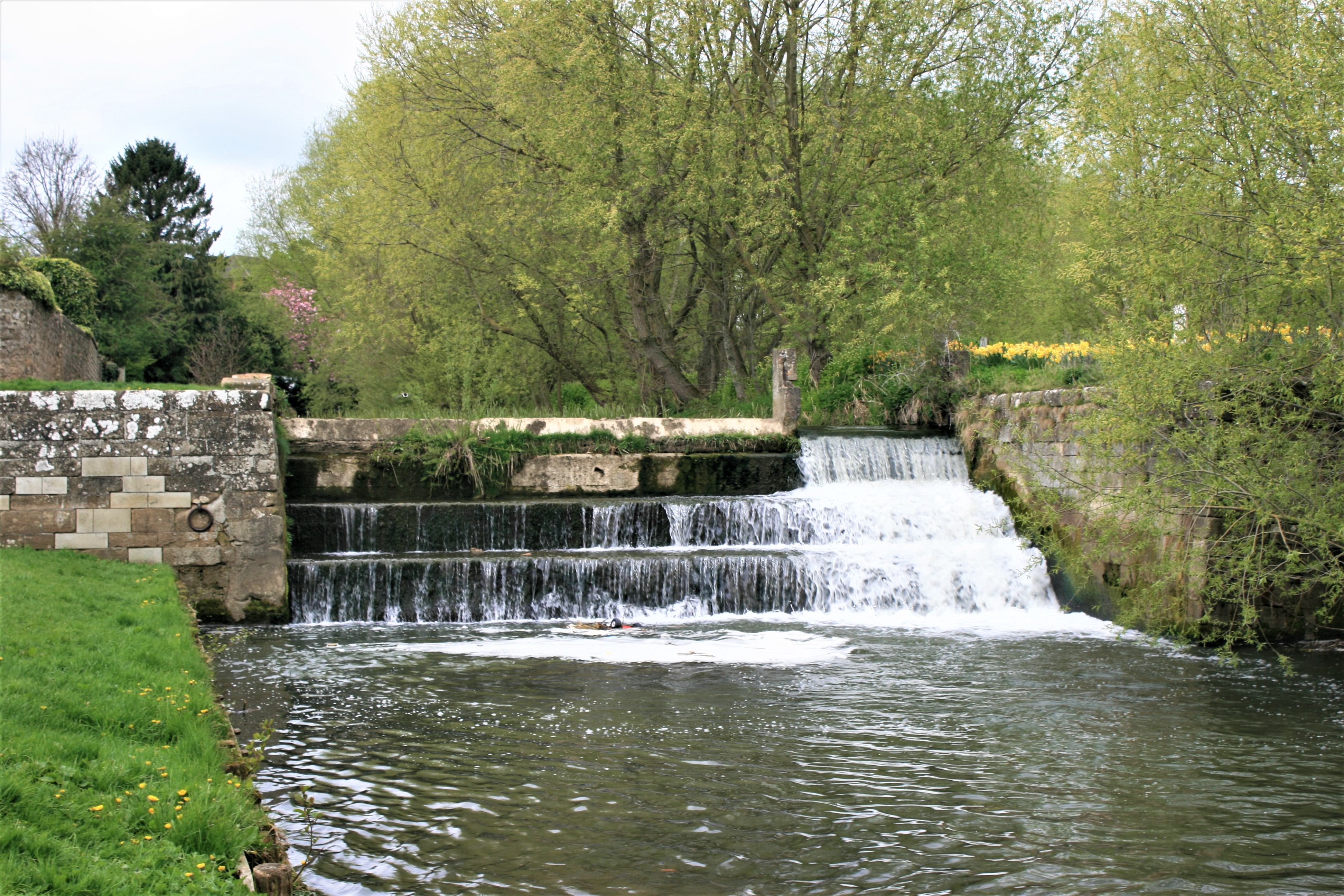
Caption: Bedale harbour [View image full screen]
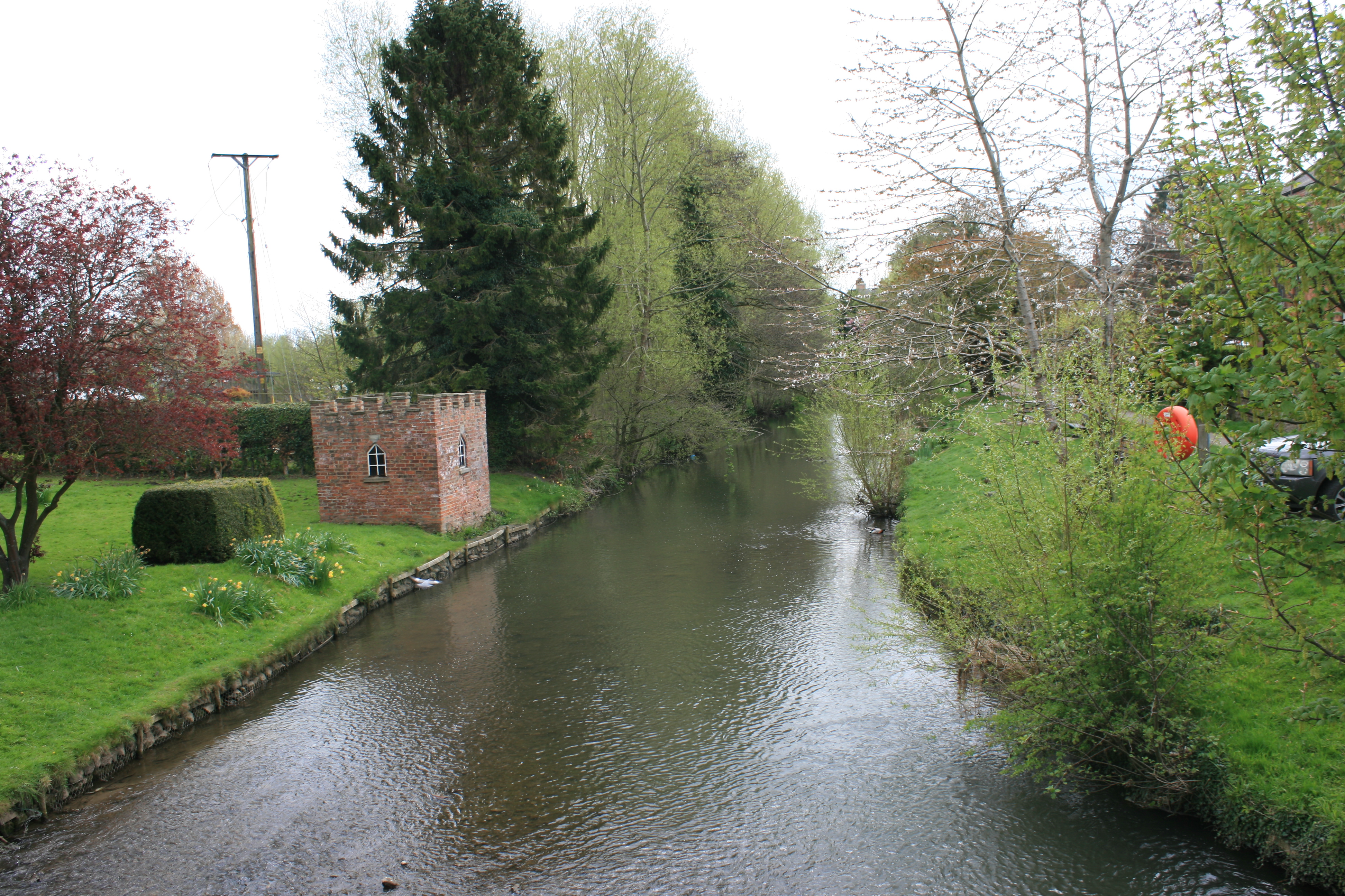
Caption: Bedale beck looking south from bridge steet [View image full screen]
- Letter from Elizabeth Montagu to Edward Montagu (EMCO ID: 2801)
- Letter from Elizabeth Montagu to Edward Montagu (EMCO ID: 2731)
- Letter from Elizabeth Montagu to Edward Montagu (EMCO ID: 2730)
- Letter from Elizabeth Montagu to Edward Montagu (EMCO ID: 2726)
- Letter from Elizabeth Montagu to Edward Montagu (EMCO ID: 2700)
- Letter from Elizabeth Montagu to Edward Montagu (EMCO ID: 2697)
- Letter from Elizabeth Montagu to Edward Montagu (EMCO ID: 2846)
- Letter from Elizabeth Montagu to Edward Montagu (EMCO ID: 2064)
- Letter from Elizabeth Montagu to Edward Montagu (EMCO ID: 2000)
- Letter from Elizabeth Montagu to Leonard Smelt (EMCO ID: 2626)
Bedale is a traditional Yorkshire market town and has been a settlement since 1251. Its Georgian heyday is still reflected in the elegant buildings lining the historic market square.
Running through the town is Bedale Beck. In February 1767, John Grundy Jr, a civil engineer from Spalding, Lincolnshire, reported favourably on the plans to render Bedale Beck and the River Swale navigable to the Ure, linking Bedale to York, Hull. The project was sponsored by Leonard Smelt, and Edward Montagu was one of the major investors in the project.
While the Swale could be made navigable with several locks, Grundy regarded the beck itself as too narrow and winding. Therefore, he recommended linking Bedale to the Swale with a new canal, estimating the whole scheme from Swale Nab to Bedale would cost just under £20,000. An Act of Parliament was obtained in April of 1767, and John Smith was appointed as the resident engineer to oversee construction.
However, rather than following Grundy’s clear plan to link Bedale to the Swale by a new canal, commissioners subsequently decided to improve the beck instead. Over the next three years, the once meandering stream was transformed into a series of largely straight cuts, which can still be seen today.
Initially, Grundy had envisaged the canal basin on the Aiskew side of Bedale Beck. This would have placed the basin 700 yards from the town centre, and it was probably for this reason that John Smith relocated the harbour to the Bedale side, a quarter of a mile closer to the town centre than its original placement. Smith also planned a lock some distance below Bedale Harbour, and stone for this was led to the field known as Dumfodders. However, as Hird’s Annals of Bedale record, “that lock was never seen.”
By mid-August of 1769, the commissioners were finding difficulty in getting promised money from benefactors, including Montagu, and, in December, all work stopped at Dumfodders. Smith estimated that a further £25,000 was needed to complete the project, and though a second Parliamentary Act was obtained in 1770 enabling the raising of further capital, there were to be no takers. Subsequently, work on the canal stopped and it has never been completed.[Information provided by Graham Hudson, ‘How a lack of cash scuppered an engineering project of the canal age’ in the Darlington & Stockton Times, (13th November 2009),
Today, you can still see the remnants of the harbour, built with funds supplied by Montagu.
Please note that all dates and location information are provisional, initially taken from the library and archive catalogues. As our section editors continue to work through the material we will update our database and the changes will be reflected across the edition.
Browser support: The website works best using the Chrome, Edge, and Firefox browsers on the PC, and only Chrome and Firefox on the Mac.
Developed, Hosted and published on behalf of EMCO by the Digital Humanities Team at Swansea University | Copyright© EMCO
Accessibility Statement | Cookies Statement | Licensing and Copyright
![]()
![]()
![]()